This is neither an endorsement nor a critique of Google...
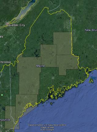
Just wanted to let folks know that Google has been busy in Maine in 2013, acquiring just shy of 18,000 square miles of imagery with pretty decent resolution - hard to say (no metadata), but I would guess it is 6" or maybe even 4.5" for the entire area. This is a real change as in the past Maine has not received Google's higher-resolution flights (just the half-meter satellite imagery). Attached is a rough index of the various areas and the dates (either 4/7/13, 8/23/13, 9/17/13, or 9/18/13).
However like all Google imagery it has the following limitations:
- Can only use it in Google Earth and Maps
- Can only use it for 'personal use' without a GE Pro license
- No metadata aside from the date - so no idea of accuracy, limitations, etc., and perhaps difficult to use in legal cases
- Dates are all over the place so data not consistent - includes snow in the April collect, full summer in the August collect, and leaves turning in September collects
So it's another resource we can all use, with caveats, but still not a replacement for consistent and authoritative orthoimagery in the public domain.
[cid:image004.jpg@01CED48C.6DEF1CA0]
===============================
Michael Smith MS GISP
State GIS Manager, Maine Office of GIS
State of Maine, Office of Information Technology
michael.smith _at_ maine.gov 207-215-5530
Board Member, Maine GeoLibrary
Education Chair, Maine GIS Users Group
State Rep, National States Geographic Information Council
[cid:image003.jpg@01CED48B.2CF6AF70]
State House Station 145
51 Commerce Drive
Augusta, ME 04333-0145
69o 47' 58.9"W 44o 21' 54.8"N
-----------------------------------------------------------------------
This list Maine GeoNews (GEOLIBRARY-L) is an unmoderated discussion list for all Maine GIS Users. If you no longer wish to receive e-mail from this list, you can remove your name and email address yourself at the this web address:
http://lists.maine.edu/cgi/wa?SUBED1=geolibrary-l&A=1
Or,you may also request that your name be removed by sending email to:
[log in to unmask]
|


