Has anybody seen an up-to-date interactive map county by county (or even
finer granularity should /Maine CDC's case tracker/
<https://www.maine.gov/dhhs/mecdc/infectious-disease/epi/airborne/coronavirus.shtml>
ever break it down by town) for Maine yet showing the confirmed cases of
COVID-19?
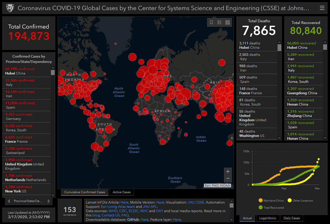
While searching around, I found this well prepared map
<https://www.arcgis.com/apps/opsdashboard/index.html#/bda7594740fd40299423467b48e9ecf6>
by the Center for Systems Science and Engineering (CSSE) at Johns
Hopkins University (JHU). The things about it I liked most include that
it provides /Total Recovered/, metadata, in addition to it apparently
being updated with each refresh. Data centroids are currently at the
state/province level, though had previously been reporting at the county
level up until March 10. JHU's map is expected to return to county-level
reporting once their platform has is proven robust enough to handle the
coming tsunami of data.
--
V. Kelly Bellis
17 Union Street
Ellsworth, ME 04605
[log in to unmask]
-----------------------------------------------------------------------
This list Maine GeoNews (GEOLIBRARY-L) is an unmoderated discussion list for all Maine GIS Users. If you no longer wish to receive e-mail from this list, you can remove your name and email address yourself at the this web address:
https://lists.maine.edu/cgi-bin/wa?SUBED1=GEOLIBRARY-L&A=1
Or, you may also request that your name be removed by sending email to:
[log in to unmask]


