Log In
LISTSERV Archives
Search Archives
Register
Log In
GEOLIBRARY-L Archives
Maine GeoNews
GEOLIBRARY-L@LISTS.MAINE.EDU
LISTSERV Archives
GEOLIBRARY-L Home
Log In
Register
Subscribe or Unsubscribe
Search Archives
Options:
Use Forum View
Use Monospaced Font
Show Text Part by Default
Condense Mail Headers
Message:
[
<< First
] [
< Prev
]
[
Next >
] [
Last >>
]
Topic:
[
<< First
] [
< Prev
]
[Next >] [Last >>]
Author:
[
<< First
] [
< Prev
]
[
Next >
] [
Last >>
]
Sender:
Maine GeoNews <
[log in to unmask]
>
Date:
Fri, 29 Sep 2017 19:09:58 -0400
Reply-To:
"V. Kelly Bellis" <
[log in to unmask]
>
Message-ID:
<
[log in to unmask]
>
Subject:
Re: sea-level in 2' contour shapefiles?
From:
"V. Kelly Bellis" <
[log in to unmask]
>
Content-Type:
multipart/alternative; boundary="------------6AE08B3BD6EB7EDBD97D2DF6"
In-Reply-To:
<
[log in to unmask]
>
MIME-Version:
1.0
Comments:
To:
[log in to unmask]
Parts/Attachments:
text/plain
(4 kB)
multipart/related
(4 kB) ,
text/html
(11 kB) ,
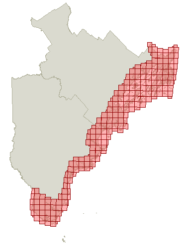
Cumberland and York.PNG
(13 kB) ,
Cumberland Lidar.PNG
(207 kB) ,
Cumberland Lidar.PNG
(30 kB)
Your browser doesn't support iframes.<br /><br /><a href="/cgi-bin/wa?A3=1709&L=GEOLIBRARY-L&E=8bit&P=511482&B=--------------35CA6E829D6CE547D64D1533&T=text%2Fhtml;%20charset=utf-8" target="_blank">View Message</a>
ATOM
RSS1
RSS2
LISTS.MAINE.EDU


