Hi Emily,
Thank you for all of you efforts for our community of spatial data users keeping MEGIS data available.
On the page: https://www.maine.gov/geolib/data/index.html, there is mention of WMS, among other types of services. There used to be instructions on the Data Catalog pages for the procedures to add a web mapping service to various GIS softwares, including the bits I wrote for Global Mapper back in the day of Mike Smith. Such instructions are no longer seen on the catalog page, now at: https://www.maine.gov/geolib/catalog.html
Additionally, none of the previously configured WMS connection
details that I had added in Global Mapper's Online Data Sources
function. All attempts return cryptic error messages.
I'm guessing that things have changed on MEGIS servers and I must delete all previously configured Online Data Sources from MEGIS and to Add New Sources for MEGIS, but will need some help please. Could you provide instructions on how I can set things to work in Global Mapper, or at least some procedural outline?
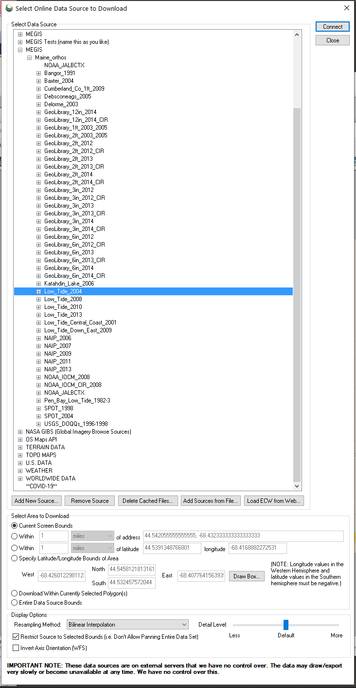
Here's a screen shot of Global Mapper's dialog box (v22.1) in case it might help.
Thank you very much.
Kind regards,
Kelly
[log in to unmask]">Hello Maine GeoLibrary Data Catalog Consumers,
Announcement:
GIS image services have returned to normal function. MaineIT applied an update to the storage environment that appears to have had a positive impact on the services. The Maine Office of GIS is monitoring and collecting data to help affirm this is a longer-term fix. In the meantime, please feel free to resume regular use of these services. If users encounter a renewal of the imagery performance issue, or any newly impacted items, please reach out to us with details.
Thank you for your patience.
Sincerely,
Emily Pettit
----------------------------------------------------------------------- This list Maine GeoNews (GEOLIBRARY-L) is an unmoderated discussion list for all Maine GIS Users. If you no longer wish to receive e-mail from this list, you can remove your name and email address yourself at the this web address:
GIS Coordinator
Maine Office of GIS
[log in to unmask]
https://www.maine.gov/megis/https://lists.maine.edu/cgi-bin/wa?SUBED1=GEOLIBRARY-L&A=1
Or, you may also request that your name be removed by sending email to: