Sent: Tuesday, March 17, 2020 3:32 PM
To: [log in to unmask] <[log in to unmask]>
Subject: [EXTERNAL] Mapping COVID-19
Has anybody seen an up-to-date interactive map county by county (or even finer granularity should Maine CDC's case tracker ever break it down by town) for Maine yet showing the confirmed cases of COVID-19?
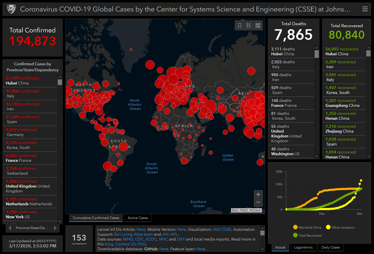
While searching around, I found this well prepared map by the Center for Systems Science and Engineering (CSSE) at Johns Hopkins University (JHU). The things about it I liked most include that it provides Total Recovered, metadata, in addition to it apparently being updated with each refresh. Data centroids are currently at the state/province level, though had previously been reporting at the county level up until March 10. JHU's map is expected to return to county-level reporting once their platform has is proven robust enough to handle the coming tsunani of data.
https://lists.maine.edu/cgi-bin/wa?SUBED1=GEOLIBRARY-L&A=1
Or, you may also request that your name be removed by sending email to: